AOTEA ROAMERS
 

Waipakihi River Camping

Via Urchin Track


A flexible length hike with impressive views over the central plateau

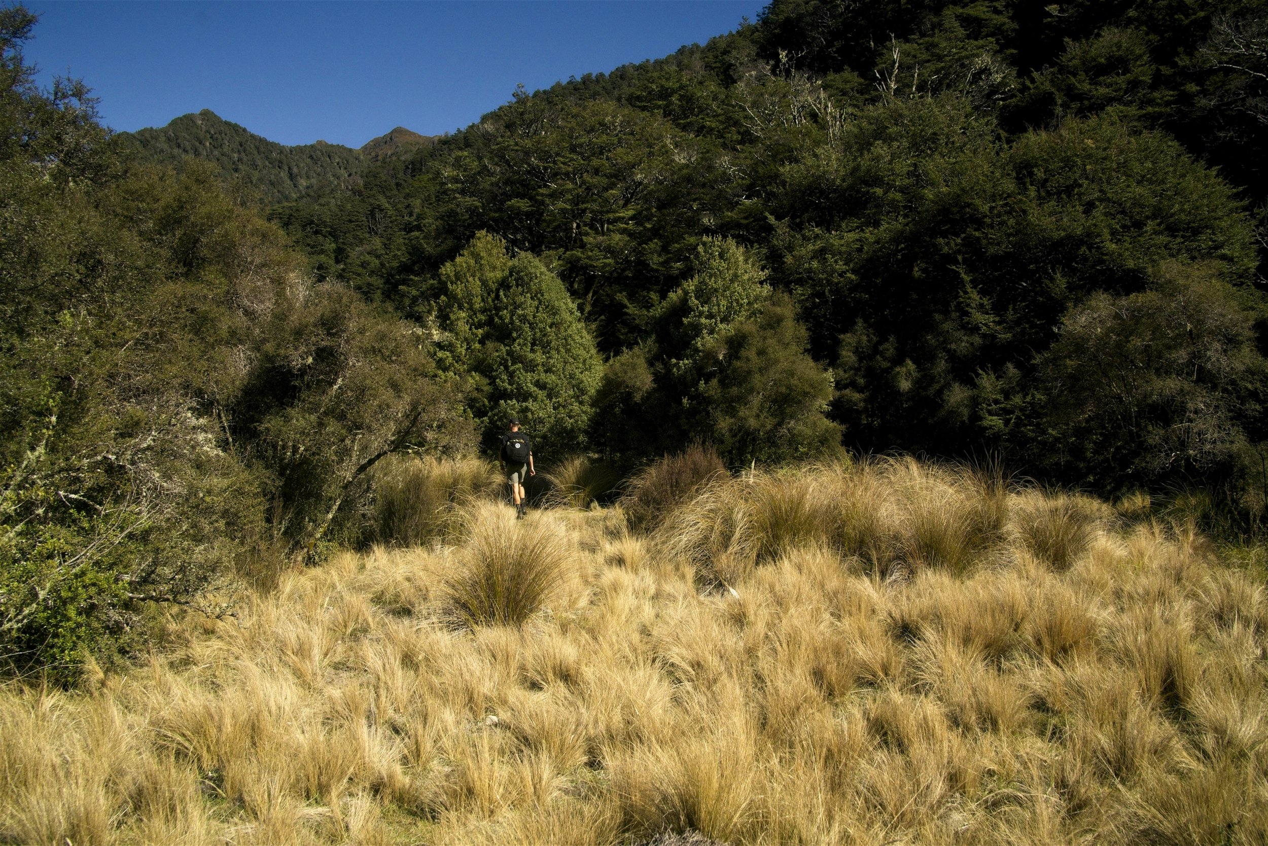
The Waipakihi River in the Kaimanawa mountain range is a popular spot for deer hunters all year round but more specifically during the Autumn roar. The journey here takes you over Urchin Peak with an incredible over the central plateau and afterwards down into the gorgeous Waipakihi River valley lined with a well-established mountain beech forest with camp sites aplenty


DSC01304-High.jpg

Summary

Time to complete

2-3 Days

Accommodation style

Camping (Free)

Track type

There and back - Return via same track. Loop option.

Distance

8km each way

Difficulty

Medium

Bookings required

No


Highlights

  • Expansive views of the central plateau volcanic peaks

  • A flexible length trip - camp where you like

  • Stunning established mossy mountain beech forests

  • Cool off in the Waipakihi River

  • 3 Day loop option by incorporating Waipakihi Hut

  • Dogs allowed (Doc permit required)


DSC01372-High.jpg

Page Navigation


All about the trail

The Waipakihi River is a true gem of the central North Island. Most people would be surprised if you said photos from this area are located in the North Island. It’s a place that is off the beaten path and this makes it all the more exciting. Located between the Kaimanawa Mountain Range and the Umakariri Range, this area is a popular spot for deer hunters but hikers are welcome of course. The beech forests here are incredibly beautiful-full of moss and so green, and walking over the tops is such a fantastic experiecne with the alpine vistas.

My suggestion would be avoid the “Roar” time periods as what would usually be tranquil valley turns into a somewhat busy area with hunters making camp all over the place.

This is an easy walk, however some simple route finding is required over the tops, generally walking from pole to pole but on an obvious trail. Once down at the river, the trails to stop and start as you walk up the river, however given the small river banks, it’s not somewhere you are going to get lost.

Track condition
-Great track condition until the river is met. From here there are reasonable tracks up the river however these stop and start in places.

Optionals
-Spend an extra night and continue up the river staying at Waipakihi Hut for night 2


Getting there

Note this track can be looped with the Waipakihi Hut track (see guide below), however for a out and back walk the start/finish is the Urchin Campground
Trail start/finish location: Urchin Campground


Sleep

-Huts:

Camping only, unless you walk all the way up the river to Waipakihi Hut

-Camping:

Many campsites along the river, free

-Booking:

Not required

-Back-country hut pass:

N/A

What To Take

Being in the Central Plateau area, the track is subject to extreme weather and can become dangerously cold even during the summer. Be sure to pack warm clothing and a suitable sleeping bad and mattress for the season/forecasted conditions.

Summer | Example packing list

Spring + Autumn + Winter | Example packing list

Winter Hiking

The trail is suitable all year round. The tops however are very exposed and care must be taken during storm conditions. Note the weather in the Kaimanawas can often be different to the weather around Mt Tongariro area, so be wary of relying completely on the Tongariro National Park weather forecast.

Website And Other Links

Department of conservation website | Tongariro National Park Weather

Elevation Profile


Trip Guide

DSC01368-High.jpg


Day 1 | Carpark to Waipakihi River campsite

8km | 2.5-4.5 Hours

1-1.5hr | Urchin Peak
The trail starts with a steady 4km climb on well kept trails through native bush. The Urchin peak is found shortly after emerging from the tree line.

1.5-3hr | Camp site
After reaching the peak, travel along the obvious tracks over the tops until a side trail is met. Follow the trail down back into the bush-line towards the river below. The trail here eventually descends steeply into the valley through a wonderful mossy beech forest eventually following a stream down to the valley floor. At the bottom where the trail directly meets the river you will find an unofficial campsite (no toilets). Pitch a tent here or carry on up the river for 0.5-1.5 hours to find a more secluded spot of your own.

3 day loop version
-If conditions allow, day 2 could be spend following the river upstream to reach Waipakihi Hut for night 2
-Alternatively, head up the thunderbolt track (note not located on topo maps 100% correctly from what I’ve been told) and follow the Kaimanawa tops to reach Waipakihi Hut.


Day 2 | Waipakihi River campsite to Campsite

8km | 2.5-4.5 Hours

2.5-4.5hr
The track back to the carpark follows the same one walked on day 1.

3 day loop version
-If conditions allow, day 2 could be spend following the river upstream to reach Waipakihi Hut for night 2
-Alternatively, head up the thunderbolt track (note not located on topo maps 100% correctly from what I’ve been told) and follow the Kaimanawa tops to reach Waipakihi Hut.