AOTEA ROAMERS
 

CAPE BRETT TRACK


A journey to a remote hut perched on a cliff looking overlooking the stunning Bay of Islands

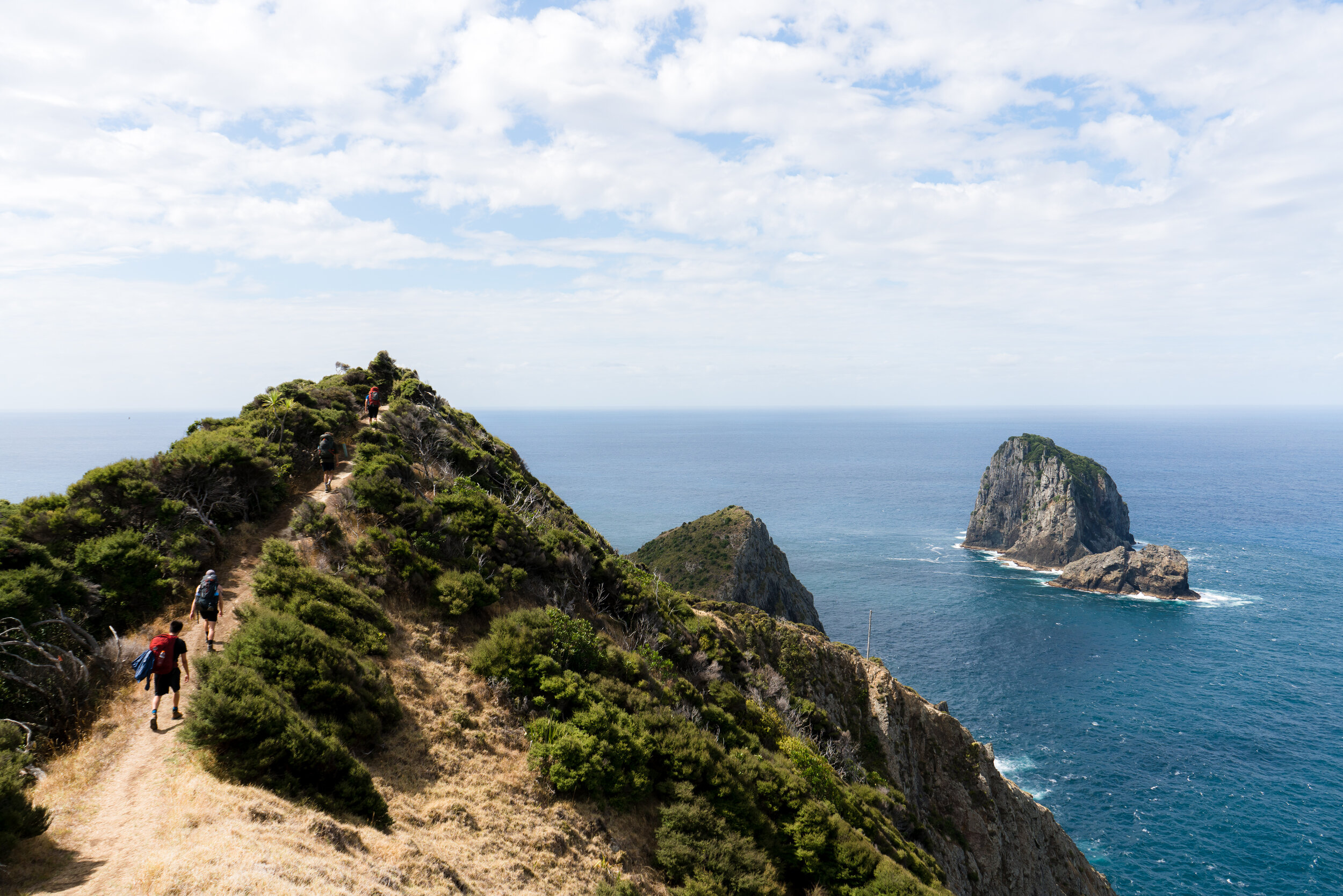
At the end of this peninsula lies the remains of an old settlement formed to maintain a lighthouse located nearby. The walk here starts inland follows an undulating path along the ridge line of the peninsula through regenerating forest, exposed cliffs and pristine secluded bays along the way. From the hut, enjoy the sunrise and sunset, snorkel amongst large kelp forests and abundant sea life and enjoy the cool sea breeze during the hot summer days.


DSC08050.jpg

Summary

Time to complete

2-3 Days

Accommodation style

Back-country hut

Track type

There and back - Return via same track

Distance

16km each way (shorter option)

Difficulty

Medium (Easy option)

Bookings required

Yes


Highlights

  • Hike along the ridge of a stunning peninsula

  • Spend the night in the old lighthouse keeper’s hut

  • Epic sunrise and sunset views directly outside the hut

  • Amazing swimming/snorkel a short walk from the hut


DSC08048.jpg

Page Navigation


All about the trail

Cape Brett is at the very tip of the prominent Rakaumangamanga Peninsula, with a lighthouse over 100 years old perched on a hill overlooking the surrounding seas. Given its remote location, a small settlement was set up here with a few families living here to look after the day to day running requirements of the lighthouse. The lighthouse was eventually upgraded to an automated system and the settlement was abandoned. The existing Cape Brett Hut is one of the houses originally used by the families and has been refurbished into a hut by DOC.

There are two options for this walk, a short and a long option. I have summarised these two options below. The longer version is about 16km long and you will find the track undulates quite a bit over this distance making it harder than you’d expect. Along the way there is plenty to keep you interested. A lot of the walk is under tree cover however there are quite a few open sections with incredible views, sheer cliff drop offs, beautiful bays to swim in and fantastic ridge line tracks. By far the most impressive bit is the location of the hut at the end.

In recent times there have been issues with the drinking water at the hut, meaning that people going here need to take their own drinking and cooking water. Due to this, it has become quite a difficult walk to do carrying possibly 5-7L of water weight. DOC are in the process of installing new tanks and a desalination unit for these tanks.

Track condition
-Good condition in dry weather however the trail can deteriorate in wet conditions

Optionals
-Spend 2 nights at Cape Brett Hut and enjoy a day of swimming and relaxing in between
-Take the water taxi to and/or from the hut to make the journey a little easier


Getting there

Short Version:
Catch a water Taxi to Deepwater Cove from Rawhiti.

Long Version:
Trail start/finish location: Oke Bay, Northland


Sleep

-Huts:

The hut is the old lighthouse keepers accomodation which has been repurposed as a backcountry hut. Facilities have recently been upgraded and new toilets and drinking water tanks have been installed.

-Camping:

Not allowed.

-Booking:

Booking required.

-Back-country hut pass:

Can be used.

What To Take

Swimming clothes, a snorkel and your usual hiking gear. It can get fairly cold and windy over the shoulder and winter season so be prepared.

Summer | Example packing list

Spring + Autnum + Winter | Example packing list

Winter Hiking

The trail is suitable all year round.

Website And Other Links

Department of conservation website | Cape Brett Weather

Elevation Profile


Trip Guide

DSC08030.jpg


Day 1 | Oke Bay to Cape Brett Hut

16km | 5-7Hours

3-4hr | Deep water Cove
The trail starts at Oke Bay. From here, it’s a fairly steep trail where the trail goes from sea level to around 350m elevation. After reaching the peak, the trail continues to undulate down and up and down again until the turn off to Deep Water Cove is met. The trail is mostly under tree cover however there are plenty of small sections where you get out from under canopy. Take 1.5-2L of drinking water to last you until the hut.

2-3hr | Cape Brett Hut
From Deep Water Cove, head up the valley until you reach a trail junction. Continue towards Cape Brett Hut as the trail undulates up and down frequently. Along the way there are some beautiful vistas when climbing to the top of some of the ridges. Eventually the lighthouse will be met and it is just a short stroll down to the hut.

Short version
-Catch a water taxi to Deep Water Cove and follow the instructions above
-If doing the long version, make a stop at Deep Water Cove on one of the days if the weather is nice. It’s a fantastic swimming spot.


DSC08046.jpg


Day 2 | Cape Brett Hut to Oke Bay

16km | 5-7 Hours

5-7hr
The track back to the carpark follows the same one walked on day 1.

Optional
-Return via a ferry from Deep Water Cove to shorten your second day.


DSC08050.jpg